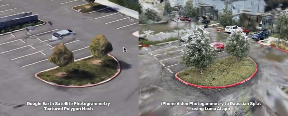
3DStreet's mission is to empower anyone to visualize safer streets. A common request to support this mission is to bring in local real-life elements from your actual streets by scanning them into 3D objects. Until now, the best technology for doing this (photogrammetry to textured 3D polygons) resulted in huge file sizes, difficult to edit output files, and gooey visuals like melting trees or cars that you may see on Google Maps in 3D mode.
Enter Gaussian Splatting -- earlier this year a groundbreaking photogrammetry and visualization technique called gaussian splatting was released as part of a research paper published at SIGGRAPH 2023. I believe splatting to be the best modern method to allow everyday users like you and me to scan 3D objects with our phones and retain the fine detail of organic material especially plants, trees, flowers and other natural elements -- all things we'd like to see more of in our streets!

This is still an R&D project, not yet a supported built-in feature of 3DStreet. In this post we share research and progress on how we are improving the visual appearance of compositing new scenes from multiple splats using depth buffer and selective splat discarding in three.js and A-Frame, underlying 3D frameworks supporting 3DStreet.

